San Carlos

Bastion of the Cuyo tradition, San Carlos appears in the Uco Valley as an indelible mark of the past and the struggles that gave rise to it. Vineyards, avenues, sunflowers border its paths framed by the foothills landscape and exciting activities.

Dazzling panoramas of mountains, oasis and desert, and a vast history of cultures and traditions, are combined in San Carlos with the simplicity of the people of the town, making it an ideal place for rest, reflection and discovery. Tourist circuits religious, challenging adventure proposals, rural alternatives along the roads of Altamira, and much more to find at every step, San Carlos is an interesting destination without a doubt as an unforgettable experience.

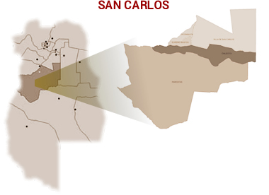
It has excellent services to the tourist, basing its offer of accommodation fundamentally in inns, farms and rural stays, but also supporting itself in urban lodgings and campsites conditioned with good comforts. It is located in the west center of the province of Mendoza, separated by about 100 kilometers from the capital city. It limits to the north with Tunuyán and to the south with San Rafael.


Watch Video

Tour Activities

San Carlos has passionate green valleys and crystal clear waters under a sky full of sun.
There, there are several tourist circuits to take into account when visiting this department.

* The Southwest Circuit *
Integrated by Route 40, it crosses Eugenio Bustos, Chilecito and Pareditas, advances through the area of streams Yaucha, Gateado and Papagayos, and presents ideal places to camp, hunt and fish. By new route 40, you get to Agua del Toro, in San Rafael.

* The Northeast Circuit *
It crosses the Fort of San Carlos, seven kilometers to the east. Geographically, it runs through the Villa de San Carlos, which is like an island determined by the union of the Yaucha and Aguanda streams, and both form the San Carlos, which spills its waters into the Tunuyán River.

* The Southeast Circuit *
This route is made by the new or old route 40 until Pareditas, and then by route 143, the Aguanda stream is crossed, to which the Aguanda and San Juan forts were built. In Chilecito, deviating from route 40 east on Florida Street, is the Aguanda dam, a suitable place to camp. At eight kilometers from Pareditas, is the Paso de las Carretas.

* Roads of Altamira *
It is part of rural tourism and is located in the town of La Consulta. This tour is part of the Uco Valley route, irrigated by the Tunuyán River and a large number of minor water courses, which make it a very fertile and pleasant valley for life. Its position a thousand meters in front of the front mountain range, not only allows you to enjoy the best views of the mountain range, but also, have the best land for the cultivation of fine vines. This environment constitutes a landscape of exceptional landscape and productive relevance.

* Diamond Lagoon *
It is located 70 kilometers from the capital city of San Carlos, in the Pareditas district. Declared a Water Reserve in the custody of the glaciers that give rise to the surface water courses and subterranean water that irrigates, basin below, the oasis of the Uco Valley.


........................................
Choose another City


.